Our Services
Aerial Photos
High-resolution images of properties, construction progress, events, and business locations - providing a clear, elevated view for marketing and documentation.

Video Capture
Aerial video and thermal video services for commercial projects in Houston. Capture properties, operations, and environments from a clear elevated perspective with high-resolution drone footage and thermal imaging
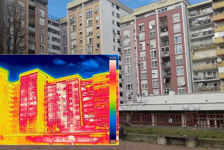
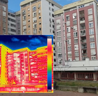
Thermal visuals that reveal hidden temperature patterns, helping property owners, facility managers, and contractors detect heat loss, moisture intrusion, and energy inefficiencies.
Thermal

Drone Thermal Imaging Services in Houston, Texas
Aerial Infrared Imaging & Drone Thermography for Commercial & Residential Projects
At Resolution Drone Services, we provide professional drone thermal imaging in Houston, Texas using advanced aerial infrared technology to detect temperature variations that are not visible to the naked eye. Also known as drone thermography, this process helps identify heat loss, moisture patterns, insulation gaps, and equipment irregularities—quickly, safely, and without invasive methods.
By combining thermal data with high-resolution aerial imagery, clients gain a clear, real-world view of conditions—supporting faster, more informed decisions across commercial, industrial, and real estate projects.
What Is Drone Thermal Imaging?
Drone thermal imaging is a form of aerial infrared data capture performed using an unmanned aircraft system (UAS) equipped with a thermal camera. These systems detect heat signatures across surfaces and translate temperature differences into visual data.
This allows patterns, anomalies, and potential problem areas to be identified in a way that standard photography cannot provide.
For advanced applications, radiometric thermal imaging can record temperature values within each image, enabling deeper analysis and documentation over time.
Why Use Drone Thermal Imaging in Houston?
Efficient Coverage of Large Properties
Capture rooftops, commercial buildings, industrial sites, and solar arrays across the Houston area in a fraction of the time compared to manual methods.
Improved Job Site Safety
No need for ladders, lifts, or direct contact with hazardous surfaces—data is collected remotely from above.
Repeatable Data Collection
Flight paths can be replicated for consistent monitoring—ideal for tracking changes in roofing systems, equipment, or property conditions over time.
Non-Invasive & Low Disruption
Thermal imaging can be performed without interrupting business operations, tenants, or ongoing work.
How Drone Thermography Works
Infrared Thermal Sensors
Capture temperature differences and display them as color-mapped imagery for clear visual interpretation.
Radiometric Imaging (When Required)
Records temperature data within each pixel, supporting detailed documentation and comparative analysis.
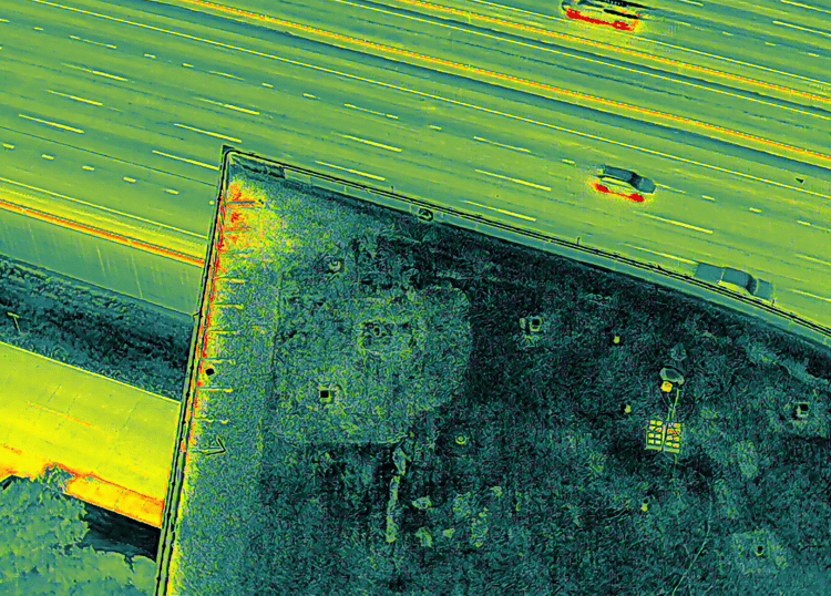
Thermal Mapping (Orthomosaics)
Multiple aerial images can be stitched into a high-resolution thermal map, providing a comprehensive overview of large areas such as commercial roofs, facilities, and land parcels.
Key Benefits of Aerial Thermal Imaging
Identify potential issues early before they become costly
Reduce guesswork with clear, data-driven visuals
Support maintenance planning and project decisions
Save time compared to traditional assessment methods
Gain a full-property perspective from an aerial view
Common Applications in Houston & Surrounding Areas
Commercial Roofing Systems
Highlight moisture patterns, insulation deficiencies, and heat loss across large roof surfaces
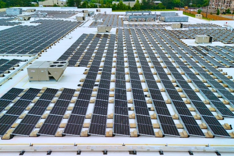
Solar Panel Systems
Identify underperforming panels and temperature inconsistencies
Industrial & Mechanical Equipment
Detect irregular heat signatures that may indicate inefficiencies
Important Texas Compliance Note
Resolution Drone Services provides aerial imaging, thermographic data capture, and visual analysis services. We do not perform licensed home inspections, engineering evaluations, or code compliance determinations.
Thermal imaging is a non-destructive tool used to identify patterns and potential areas of concern, and findings should be reviewed by a licensed inspector, professional engineer, or qualified specialist when required under Texas law.
If you're searching for thermal drone services in Houston, Resolution Drone Services delivers reliable, high-quality aerial infrared imaging and thermography for commercial, and property-focused projects.
Thermal imaging services provide a visual overview of temperature variations across a property or asset. Using drone-mounted sensors, we capture and deliver 2D thermal maps and imagery that help identify potential areas of concern such as heat loss, moisture intrusion, or irregular patterns. These services are intended for general assessment and documentation and are not a substitute for licensed engineering or certified thermographic analysis.
Thermal imaging is a powerful non-invasive tool that helps many industries and professionals detect hidden problems early.
Thermal drone imaging helps detect problems early, reduce risk, and provide clear, actionable insight - without invasive inspection methods.
Who Can Benefit from Thermal Drone Services?
Thermal imaging helps identify hidden issues like heat loss, moisture, and equipment problems—quickly and without disruption.
Property Owners & Real Estate
Homeowners, investors, agents, and property managers
Benefit: Detect insulation issues, roof leaks, and hidden moisture before they become costly repairsConstruction & Contractors
General contractors, roofers, HVAC technicians, inspectors
Benefit: Identify air leaks, missing insulation, and moisture during or after constructionFacilities & Industrial Operations
Warehouses, manufacturing plants, schools, hospitals
Benefit: Detect overheating equipment and energy inefficiencies safelyEnergy & Electrical
Solar operators, electricians, utility companies
Benefit: Identify faulty panels and electrical hotspots earlyEquipment & Heavy Industry
Trucking, marine, and equipment operators
Benefit: Monitor heat issues and catch mechanical problems earlyInsurance & Risk Assessment
Insurance adjusters and risk managers
Benefit: Support claims and identify potential risks
Projects
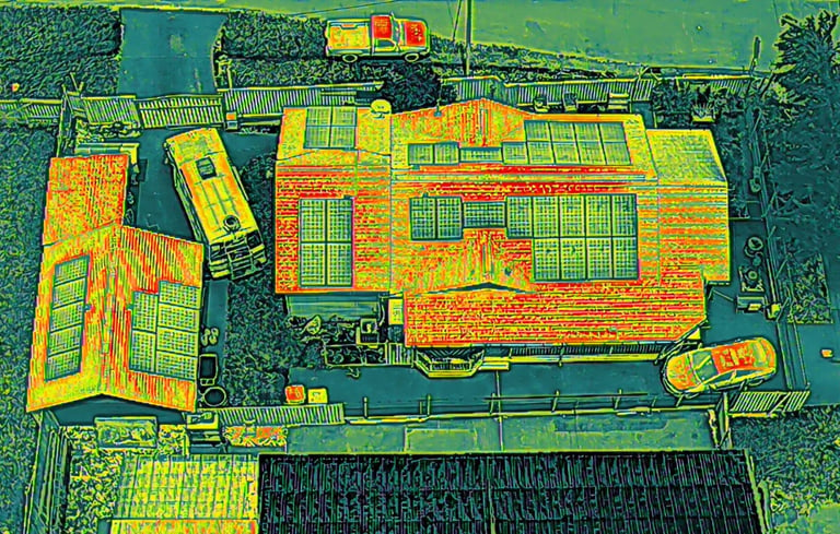
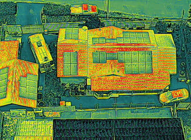
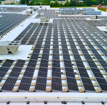
Solar Panel Thermal Imaging
Thermal imaging of solar panels helps reveal heat irregularities that may indicate underperforming or compromised areas, supporting efficient system monitoring and maintenance.
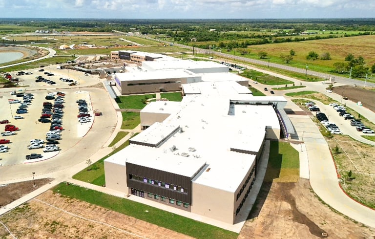
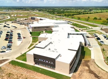
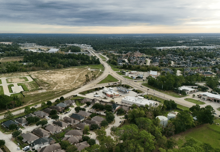
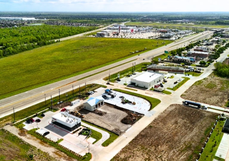
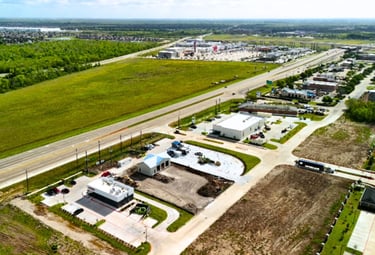
Construction Progress Monitoring
High-resolution aerial imagery provides clear, consistent documentation of project progress, helping teams track development, identify changes, and stay aligned.
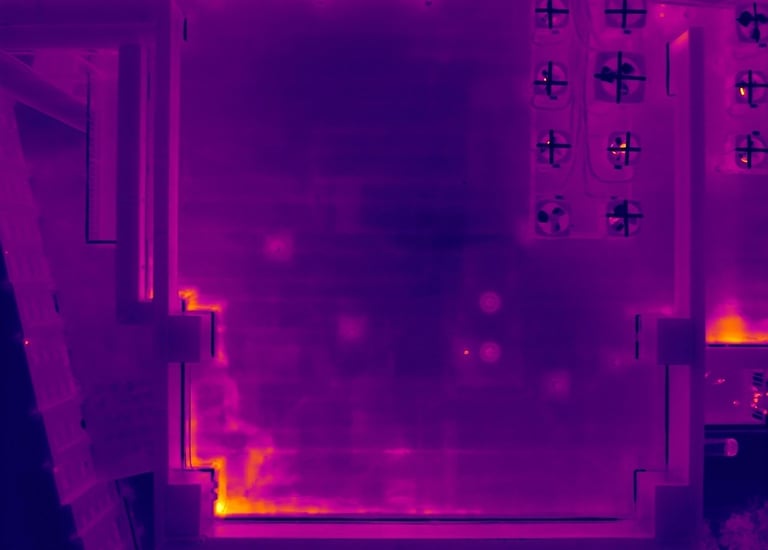
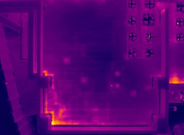

Qualitative Thermography
For Commercial Roofing, detecting moisture intrusion or heat loss. Infrastructure: shows inefficient electrical and motors. When something is running hot but other stuff is not, find out via thermal imaging.
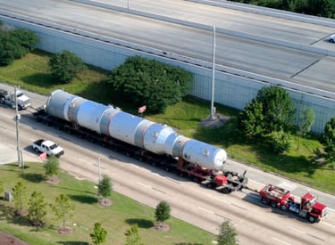
Aerial Documentation for Heavy Haul or Big Lift Projects
Drone video provides a clear visual record of heavy haul operations, supporting project documentation, client communication, and marketing efforts, where permitted by airspace.
→
→

Contact Us
Ready to capture your project from above? Reach out!